US West Coast Trip in a Cirrus SR22T G5
A flight report from a West Coast tour in a nearly new Cirrus SR22T G5 - from San Carlos to Las Vegas, Sedona, San Diego, Santa Monica, and over the Golden Gate Bridge at 1,000 ft.
On this page
Right after completing my IR Validation in California, I had planned a tour along the US West Coast.
I rented the aircraft from JATO Aviation, the largest Cirrus charter operator in the Valley. The checkout flight took several hours with Lucas and covered everything - from simulating an AHRS failure during an ILS final approach, to mountain flying, to a high-altitude checkout at 25,000 ft. The oxygen masks are honestly quite uncomfortable, and communicating on the radio with them on is really not easy.
Practicing Radio at Untowered Airports
One thing I really enjoyed was practicing radio calls at untowered airports - in our case, Lake Tahoe:
“Lake Tahoe TRAFFIC, N92NF, 5-miles final RWY 18, Lake Tahoe TRAFFIC”
The usual calls: 7 mile final, 3 mile final, short final, runway vacated, take-off. It feels a bit strange when you’re used to always getting feedback from a tower like in Germany. It’s a shame we don’t have untowered operations more widely in Europe - it would increase approach options at many airfields.
Before the trip, I watched a lot of videos from Steve Kinnevo, the American aviation video blogger, to familiarize myself with IFR radio communications in the US. That really helped - from day one I had no uncertainties on the radio.
The Cirrus SR22T G5
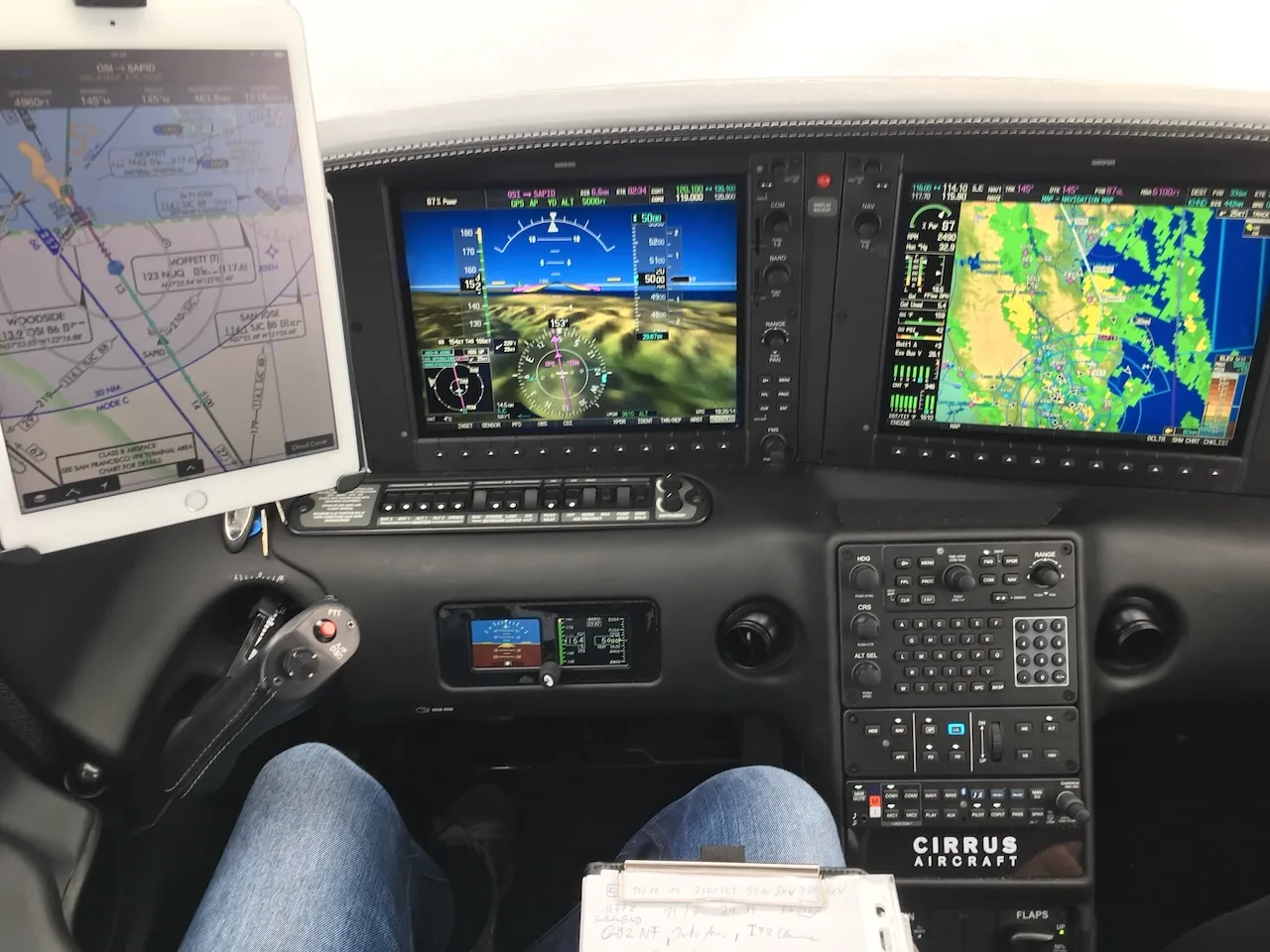
To our surprise, we got a nearly new Cirrus SR22T G5 for our trip. Very impressive right from the start was being able to set flaps already at 150 knots, which allows for noticeably faster approaches. I also immediately tried connecting directly to the Cirrus Perspective and transferring the flight plan from the iPad via Garmin Pilot.
Before my trip I had to complete a number of Cirrus certificates, including a de-icing (FIKI) certificate.
Having ADS-B traffic on the iPad, plus satellite radio in excellent quality at any altitude - absolutely brilliant.
Our Route: KSQL – KHND – KSEZ – KSEE – KSMO – KHAF
KSQL - San Carlos (Departure)
Important to know are the noise abatement procedures at San Carlos Airport.
We went straight into instrument conditions and immediately encountered our first icing, but with FIKI that was absolutely no problem.
On the way from San Carlos to Las Vegas Henderson Airport - first impressions of the G5’s Perspective with ADS-B.
KHND - Henderson Airport (Las Vegas)
Not exactly optimal - 46 kt headwind on the way in.
Great views of Las Vegas from the air.
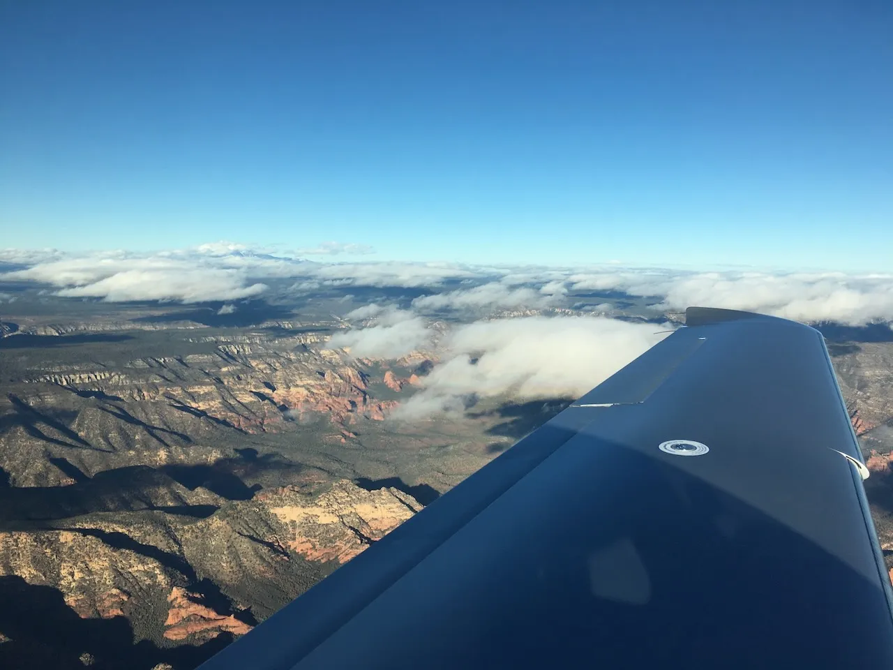
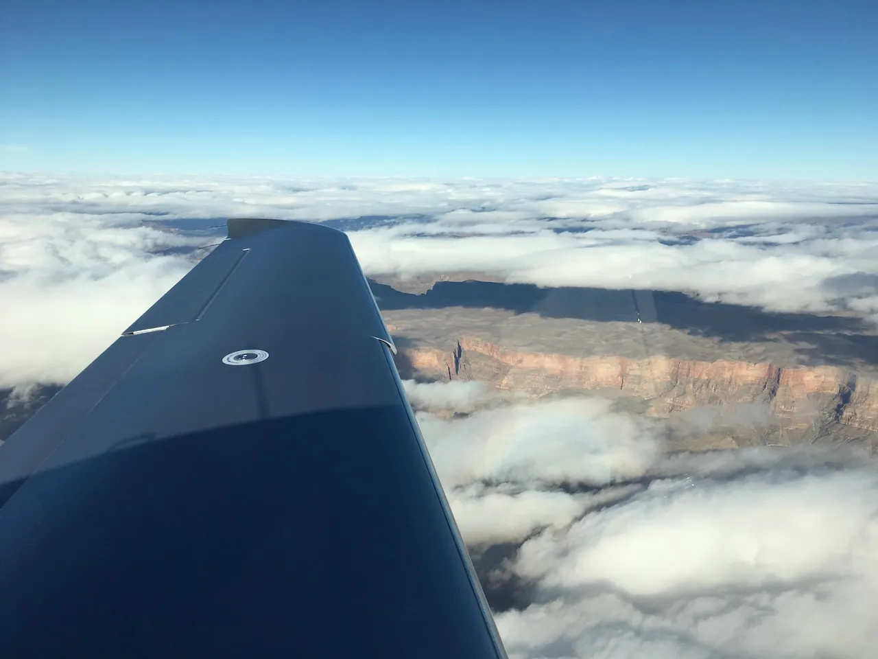
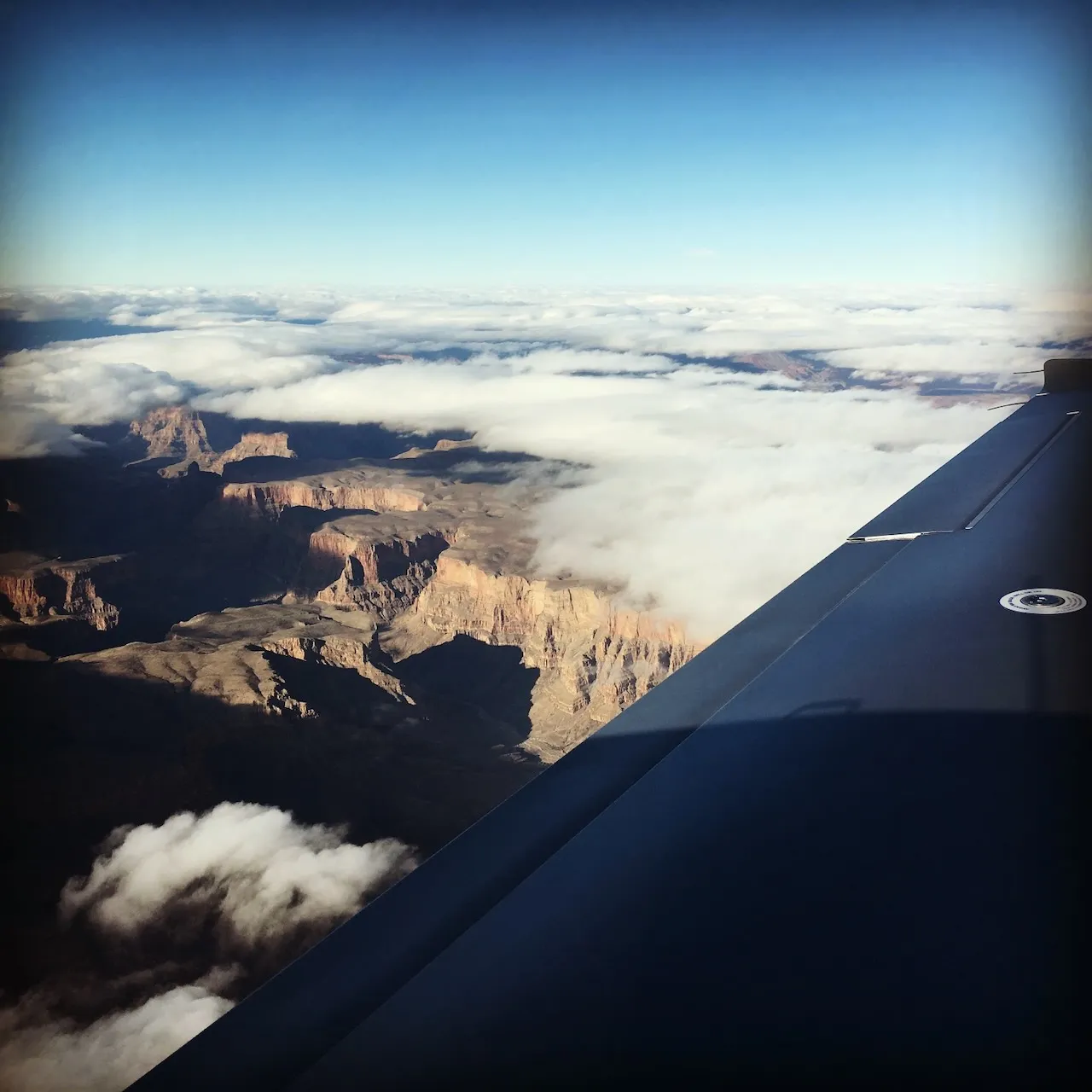
KSEZ - Sedona (Arizona)
Flight from Henderson Airport to Sedona in Arizona.
The recorded traffic pattern at Sedona.
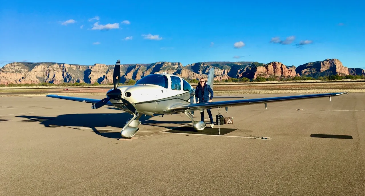
Stunning red mountain ranges at Sedona Airport.
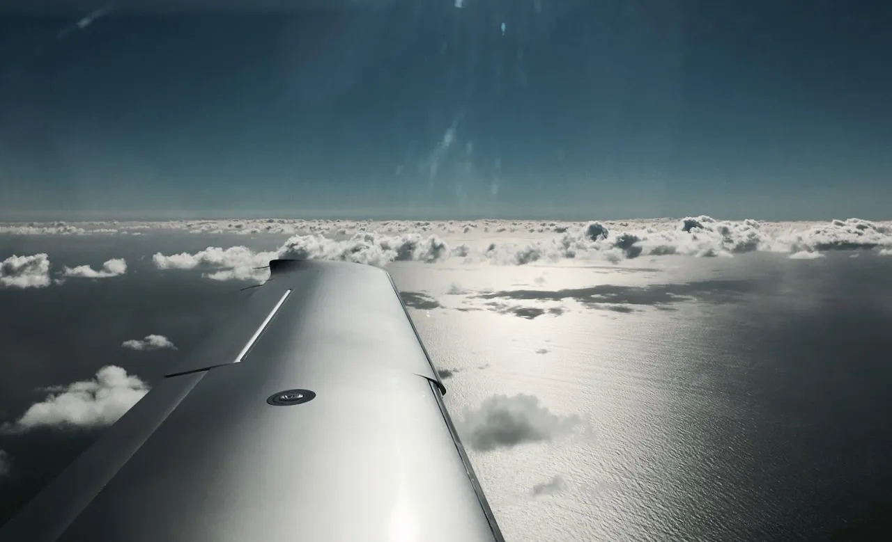
KSEE - Gillespie Field (San Diego)
On the way to San Diego.
Approach plates for Gillespie Airport near San Diego.
Satellite radio via SiriusXM with iPad control.
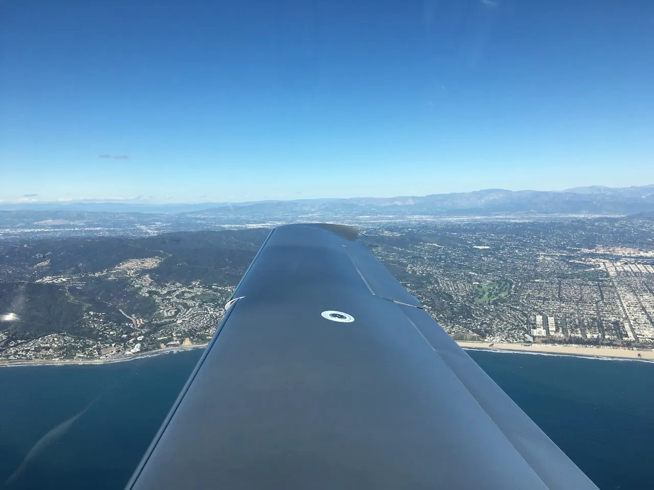
KSMO - Santa Monica
Flight along the coast to Santa Monica.
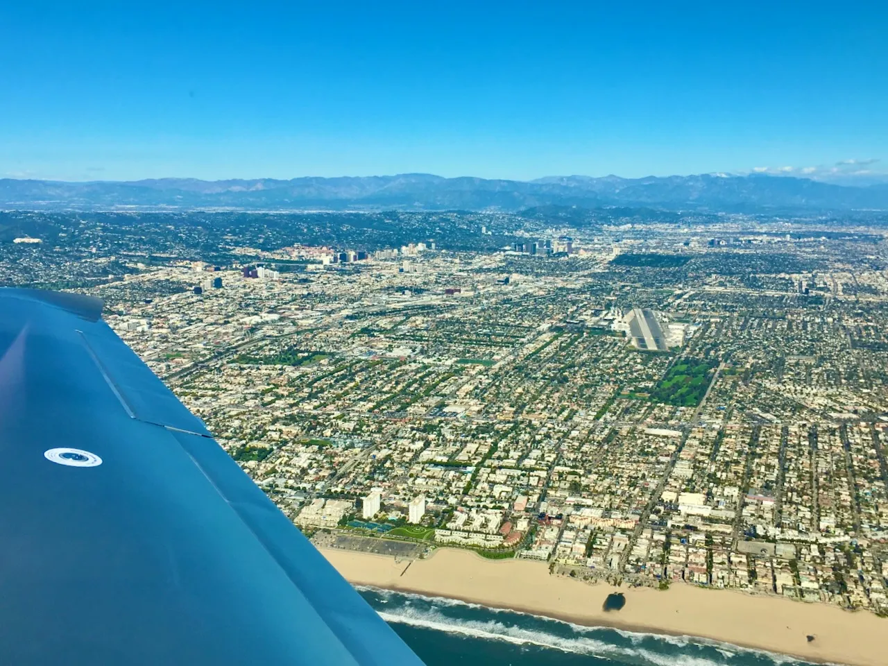
The base turn at Santa Monica Airport - I’ve flown in here several times before, but it’s impressive every time with the LA skyline in the background.
Quite busy on the Santa Monica Airport ramp.
KHAF - Half Moon Bay
Received an electronically transmitted route amendment from ATC directly into Garmin Pilot - seamless.
Downwind at Half Moon Bay Airport.
San Francisco & Golden Gate Bridge at 1,000 ft
San Francisco Bay on the way to the Golden Gate.
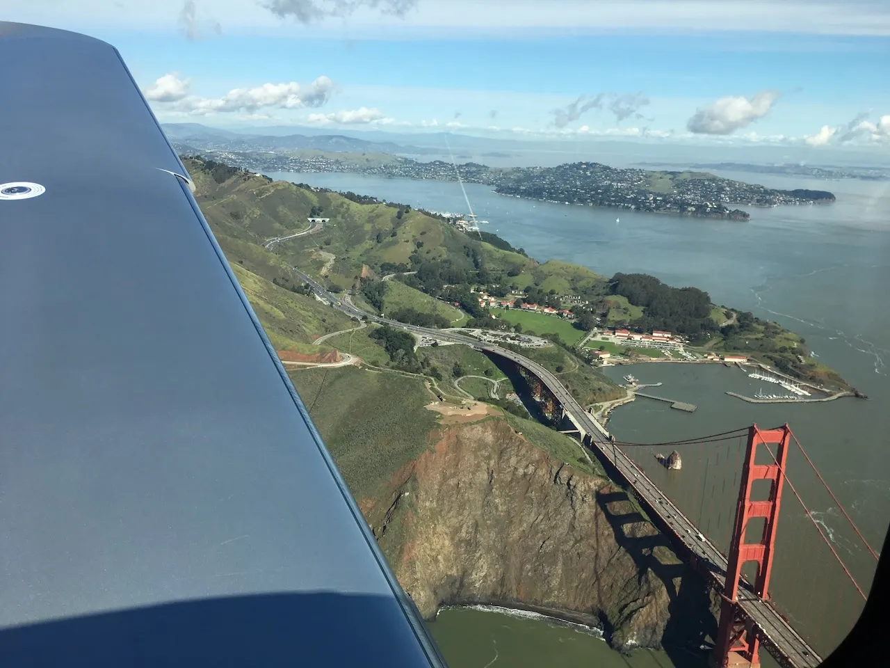
An hour at 500–1,000 ft over the Golden Gate Bridge - an unforgettable experience.

San Francisco downtown, very close.
Tips for Flying in the US
Watch the pressure units. In the US, altimeter settings are given in inches of mercury, not hPa. Most of the time the value was around 29.xx, and you get used to it fairly quickly - until a value starting with 30 comes in. When the pressure climbs above 30.00 inHg (about 1016 hPa) and you still have 29.xx dialed in, you’re suddenly 2,000 ft off!
Radio frequencies are abbreviated. Frequencies are almost always shortened to the last digits, e.g. “25.9” instead of “125.90” as we say in Europe. Something to get used to.
Garmin Pilot for everything. We flew exclusively with the Garmin Pilot app - from flight planning to filing the flight plan. Route amendments via push notifications into the Garmin Pilot app worked flawlessly.
Recommendation: Bryce Canyon. We got a tip to fly to Bryce Canyon but didn’t manage it this time - perhaps next time.
Useful Contacts
- JATO Aviation (Cirrus rental, San Carlos) - April, CEO - (650) 346-2447
Related articles
Flying the Cirrus SR22T Across Europe
Adventures and learnings from flying a Cirrus SR22T based at Schönhagen airfield near Berlin.
Cirrus SR22TN Procedures
Complete operating procedures for the Cirrus SR22TN - speeds, takeoff, climb, LOP operations, traffic pattern, landing, IFR approaches, maneuvers, and emergencies.
Cirrus SR22TN Checklists & IFR Procedures
Custom checklists for the Cirrus SR22TN - VFR/IFR main checklist, approach procedures for precision and non-precision approaches, and a complete IFR flight planning checklist.